05 January 2017

Albany Hill in Albany California and Point Isabel in Richmond California: 5 January 2017

Northern California is enjoying a short respite from a series of storms. Below are a few photographs taken from Albany Hill in Albany, and from Point Isabel in Richmond.


A view looking southwest from Albany Hill. The freeway interchange is the intersection of Interstate 80 and Interstate 580. Golden Gate Fields racetrack is visible as is the former site of the City of Berkeley's garbage dump. The landfill site behind the racetrack was the location of the city's garbage dump from the 1920's to the 1980's. The site is now known as Cesar Chavez Park. Click on the image to see the full-size photograph.


Brooks Island is straight ahead, and Mount Tamalpais is in the distance. The view is looking west from Albany Hill. Click on the image to see the full-size photograph.


Directly ahead in the center of the photo is Albany High School. Just in front of the high school are the elevated BART tracks. The view is looking east from Albany Hill. Click on the image to see the full-size photograph.


This photo of Richmond's Inner Harbor was taken from Point Isabel. This locality has historical significance: There are many oil storage tanks located on all four sides of the hill. That is the site of the first California oil refinery; it started refining oil in 1902, and it is still operational. The houses visible along the shoreline of Richmond's Inner Harbor are situated on a portion of the Kaiser Richmond World War II shipyards. The four Richmond Shipyards produced 747 ships during the Second World War, the most ships built in any US shipyard during the war. This view is looking north. Click on the image to see the full-size photo.


The Golden Gate Bridge as seen from Point Isabel Regional Shoreline. Click on the image to see the full-size photograph.


Point Isabel. Click on the image to see the full-size photo.


Point Isabel is also the location of CostcoClick on the image to see the full-size photograph.

"A camera is a tool for learning how to see without a camera.” Dorothea Lange 

"Photography has not changed since its origin except in its technical aspects, which for me are not important." Henri Carter-Bresson

"There are always two people in every picture: the photographer and the viewer." Ansel Adams
"The important thing is not the camera but the eye." Alfred Eisenstaedt


The first volume of the San Francisco Bay Area Photo Blog contains galleries of photographs that were posted on the Internet between 2002 and 2011. Click Here to view these photo galleries.

Panasonic GX7 camera body mounted with a Panasonic 14-42mm lens was used to take these photographs.

Question or a comment? I may be reached at neil@mishalov.com

01 January 2017

Mount Olympus and Buena Vista Hill, San Francisco: 1 January 2017

Buena Vista Hill, 569 feet (173 meters), is located in the Haight-Ashbury District of San Francisco. Credit for designating Buena Vista Hill as a park dates to 1868, when San Francisco Surveyor Bill Humphreys laid out the park in a master plan for the expanding city. The San Francisco Board of Supervisors formally named the hill a park on 8 May 1894. 

As the city expanded, there was a need to provide residents of the Sunset District with rapid access to that portion of the city east of Buena Vista Hill. In 1922 the city decided to build a streetcar tunnel under Buena Vista Hill. 

The successfully implemented streetcar tunnel that the city built under Twin Peaks in 1918 proved to be very popular, and it became a model for the Buena Vista tunnel. On 18 April 1925, Mayor James Rolph formally approved the $1,000,000 project. Construction of the 4,200-foot tunnel began in June of 1926. The tunnel was ready for its first passengers on 21 October 1928; it was named the Sunset Tunnel. Today, the N Judah light rail line, the sole user of the tunnel, is the busiest in the city. It served an average of 45,000 weekday passengers in 2015. Visitors to Buena Vista Park seldom know that streetcars are rumbling through a tunnel far below the hill. 


NOW This photo was taken from Buena Vista Park. It shows the University of San Francisco, a Jesuit Catholic university located on Lone Mountain. Lone Mountain was the location of the Calvary, Masonic, Laurel Hill, and Odd Fellows CemeteriesSt Ignatius Church is visible on the campus of the University. On the far right is a keyhole view of the south tower of the Golden Gate Bridge. Magnificent Mount Tamalpais overlooks the scene. The view looks northwest. 


THEN The cemeteries are visible at the base of Lone Mountain. This photo was taken in 1898. 

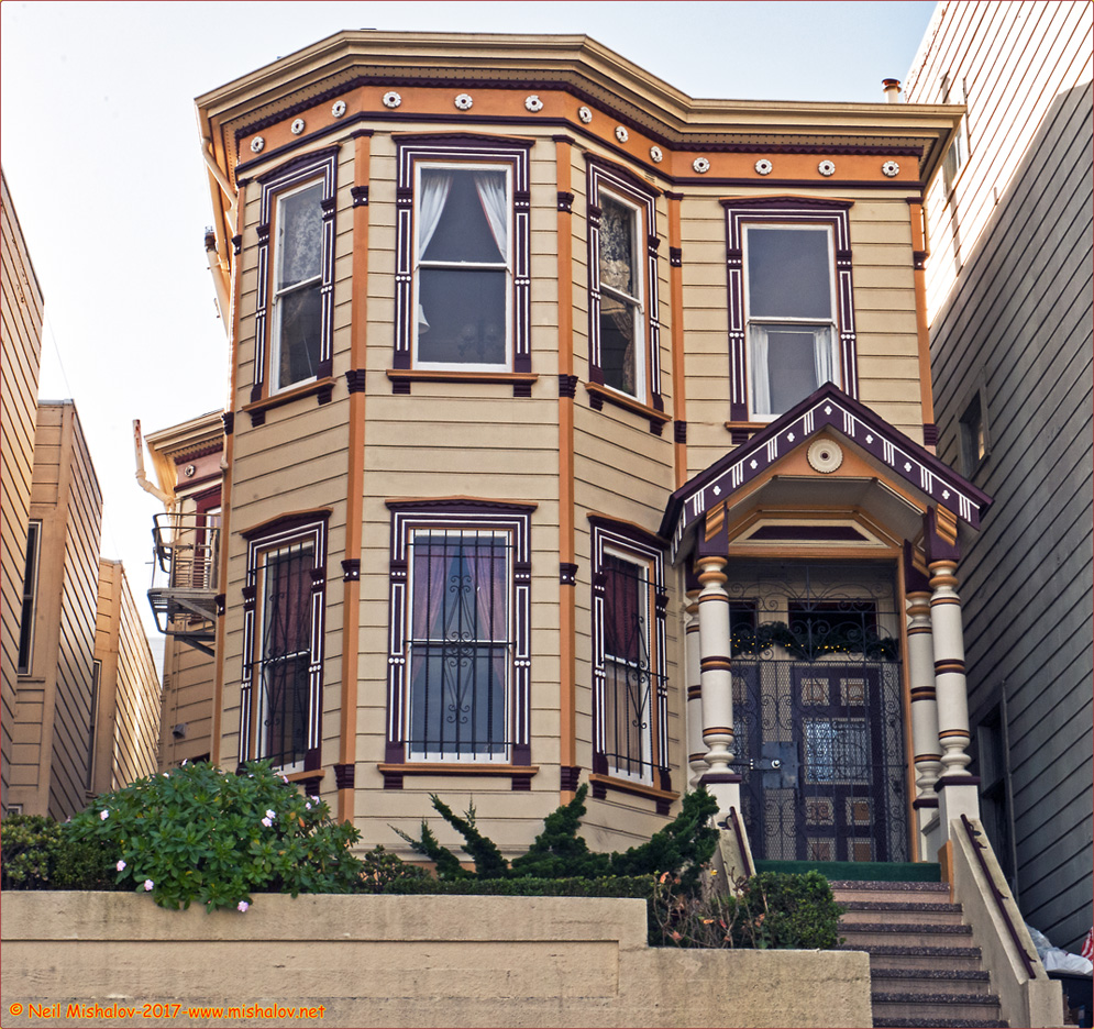
A few of the lovely houses are seen on this ramble.


This is a view of the East Portal of the Sunset Tunnel. Buena Vista Hill is above the tunnel. The view is looking west. 

 On 21 October 1928, Mayor James "Sunny Jim" Rolph piloted the first N Judah streetcar through the Sunset Tunnel. This is a view of the streetcar exiting the tunnel's Western Portal. The view is looking east. 

NOW Mount Olympus has a unique history; the 570-foot (174 meters) hill is topped by an empty pedestal. Until 1955 there was a twelve-foot-high cast concrete statue on top of the now-empty pedestal. Titled "Triumph of Light," it showed Lady Liberty. The figure was given to the City of San Francisco in 1887 by Adolph Sutro. The statue was on the top of Mount Olympus for sixty-eight years and had a hard life. The concrete weathered and crumbled; water got to the statue's metal supports, and in 1955 the city decided to remove the statue because it was deemed a hazard. All left on Mount Olympus's crest today is a massive pedestal; its inscription is defaced and illegible. Mount Olympus is located at the geographical center of San Francisco. This location provides a good point from which to view the city's beautiful vistas of bay, peaks, ocean, parks, and bridges. 

THEN The Triumph of Light statue was seen on the top of Mount Olympus in 1947.  


 An illustration of the Triumph of Light statue. The sculptor was Antoine Wirtz (1806 - 1865).

This is a view from Mount Olympus looking southeast; three visible hills. From left to right, they are: Potrero HillBernal Heights Hill, and Bay View Heights.  

This is a view from Buena Vista Park looking north. The Tiburon Peninsula and the city of Tiburon are visible across San Francisco Bay; a portion of Angel Island can be seen on the right side of the photo. 

----------

"A camera is a tool for learning how to see without a camera." Dorothea Lange 

"Photography has not changed since its origin except in its technical aspects, which for me are not important." Henri Carter-Bresson

"There are always two people in every picture: the photographer and the viewer." Ansel Adams
"The important thing is not the camera but the eye." Alfred Eisenstaedt


The first volume of the San Francisco Bay Area Photo Blog contains galleries of photographs that were posted on the Internet between 2002 and 2011. Click Here to view these photo galleries.

Panasonic GX7 camera body mounted with a Panasonic 14-42mm lens was used to take these photographs.

Question or comment? I may be reached at neil@mishalov.com